Hike, Camp, Paddle, Eat... Repeat
“Wander here a whole summer, if you can. Thousands of God’s wild blessings will search you and soak you as if you were a sponge, and the big days will go by uncounted.” —John Muir, Wisconsin naturalist
Lace up your hiking boots, slather on the sunscreen, pack a picnic— it’s time to get outside and play with the nearly half a million visitors flocking to National Park Service (NPS) destinations in Wisconsin.
With the 100th birthday of NPS on the horizon, four hot spots— the National Lakeshore of the Apostle Islands, two National Scenic Trails (the Ice Age and the North Country) and the National Scenic Riverway of St. Croix Falls—welcome you to hike, camp, paddle and eat. Here’s a few tidbits to help you choose your own adventure.
The National Lakeshore of the Apostle Islands
Hike
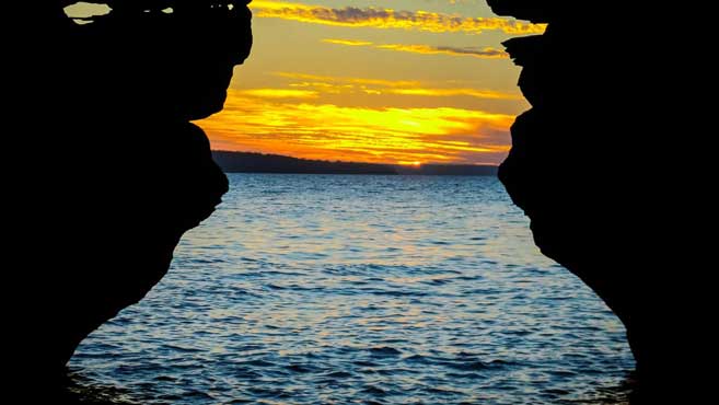
On the mainland in Bayfield, get trekking with nearly 12 miles of nature trails. Starting from the Meyers Beach parking lot, the rugged National Lakeshore Trail offers hikers views of the famed sea caves, about 1 to 2 miles into the hike.
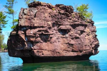
Island hoppers can jet out on Lake Superior by ferry, water taxi, or an island cruise for an up-close look at the 21 isles. On Sand Island, hike the 2-mile trail from the East Bay Campground to see the lighthouse built in 1881—it’s one of eight historic lighthouses scattered among the islands. The 1-mile South Landing Trail on Devil’s Island travels from the boat harbor to the 82-foot lighthouse tower and two Queen Anne-style keepers’ dwellings. Two short trails (1 mile and .75 mile) on Raspberry Island take you from its lighthouse to the west or east sides of the island. Whatever your destination, be on the lookout for the Islands’ small population of black bears and more than 200 species of birds.
Camp
Secure one of the Islands’ 55 campsites by getting your permit at least one month in advance. Most campsites have a fire ring, bear-proof food locker and vault toilet nearby; otherwise you can reserve a remote camping zone for a more backcountry experience, no facilities included.
Paddle
Rent a kayak and hit the water. It’s the best way to explore the sea caves and vaulted passageways along the north shore of Devil’s Island, Swallow Point on Sand Island and along the mainland. A variety of outfitters—Living Adventure is a popular one—provide rentals and shuttle services.
Eat
Pick up a lunch made with local ingredients at The Fat Radish (200 Rittenhouse Ave. in Bayfield) and catch the Stockton ferry for an island picnic. For lunch or dinner, you could also grab a bite at Greunke’s Restaurant and First Street Inn (17 Rittenhouse Ave. in Bayfield)—the legendary fried whitefish livers are talk of the town. Also plan to spend a day at one of the 15 or so orchards that surround Bayfield. Blue Vista Farm (34045 South County Hwy J), Apple Hill Orchard (34980 County Hwy J) and Good Earth Gardens (87185 County Hwy J) are a few that offer summertime berry picking.
Ice Age National Scenic Trail
Hike
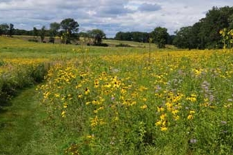
Follow the yellow mammoth trail logo marking the 1200-mile Ice Age trail that traces the edge of a glacier that once smothered Wisconsin and much of North America 15,000 years ago. The trail’s western terminus is located in Interstate State Park in St. Croix Falls, with the eastern terminus in Potawatomi State Park in Door County. Hundreds of access points throughout the state offer hikes for beginner day hikers and advanced backpackers. Nearby, the 5.6- mile Scuppernong segment rolls over hilly terrain through the Southern Unit of the Kettle Moraine State Forest. Another favorite segment is the 4-mile stretch from Holy Hill, accessible from the Stations of the Cross parking lot. More than 100 people have hiked the entire Ice Age Trail, either in sections or a single thru-hike, earning themselves the title “Thousand Miler.”
Camp
Campsites requiring permits and fees are sprinkled along the trail. And they vary from primitive grounds to more complete facilities with electric hookups. Many are located within national and state forests and parks, and can be reserved through the Wisconsin Department of Natural Resources. The Ice Age Trail Alliance sells both an atlas and guidebook, ranging from $18 to $30, detailing various campsites.
Eat
In Hubertus, WI, the cafe inside the Holy Hill Basilica offers breakfast and lunch for pre- or post-hiking fuel. If accessing the Ice Age in the Southern Kettles, pick up smoked salmon or trout from the Rushing Waters market (N301 County Rd. H in Palmyra) or grab a hummus pita and string cheese inside La Grange General Store on the corner of Kettle Moraine Scenic Drive and US-12 (W6098 US-12 in Whitewater). While hiking more remote segments, bring plenty of snacks and water, and remember to leave no trace (this means you carry your litter out with you).
North Country National Scenic Trail
Hike
The North Country Scenic Trail (NCT), established in 1980, connects cultures and landscapes from New York, Pennsylvania, Ohio, Michigan, Wisconsin, Minnesota and North Dakota, crossing more diverse geographic areas than the Appalachian Trail. In Wisconsin, NCT hikers cross the northwest tip of the state, passing by waterfalls and through varied terrain amidst the ancient Penokee Mountain Range. From the upper Michigan border, the trail dips into Wisconsin’s first designated trail town, Mellen, home to Copper Falls State Park, and extends west for about 70 miles to Wisconsin’s second trail town, Solon Springs. Passing through these parts, particularly the Chequamegon Forest, look for massive bull elk as Wisconsin continues an effort to reintroduce them to the area.
Camp
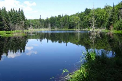
Designated campsites in Iron County Forest (near Weber Lake), Copper Falls State Park, Chequamegon National Forest, Bayfield County Forest, Brule River State Forest and Douglas County Forest are dotted along the trail for campers and backpackers. The North Country Trail Association provides detailed interactive maps and GPS data for planning your camping pilgrimage. Tip: Pack bug repellent. It’s also worth mentioning that water is abundant along the trail, but should be considered nonpotable, and treated before drinking.
Eat
The trail intersects with a speckling of quintessential small towns offering hungry hikers a limited selection of casual diners. In Mellen, Snow Creek Bar & Grill (135 E. Bennett Ave.) is a common stop for park goers at Copper Falls in search of a local fish fry. If you make it as far as Solon Springs, belly up to the bar at the Village Pumpfor pizza and beer (11575 S US Hwy 53, just south of Upper St. Croix Lake) or snag a table in town at KD’s family restaurant (11392 S 2nd St. E.) where you can order knee-slapping biscuits and gravy, just sayin’.
St. Croix National Scenic Riverway
Paddle
More than 200 miles of water highways make up the St. Croix Scenic Riverway. Two visitor centers (in St. Croix Falls and Trego) will help you plan a kayaking or canoeing excursion, along with suggested rental companies. When estimating your timeline, plan to paddle down river at about 3 miles an hour, and make sure you include the Dalles in your route; it’s known for impressive pothole rock formations ranging up to 60 feet deep. Plus it’s home to the weathered rock man peering out over the river. He goes by the humble name Old Man of the Dalles.
Camp
Riverside campsites are available on a first-come, first-served basis—no permit required. State campgrounds, however, require a permit. Look out for raccoons, bears and other critters when camping, and hang food and garbage at least 10 feet off the ground and 4 feet from the tree trunk. Also, it’s highly frowned upon to wash dishes in the river, so bring collapsible or portable sinks if you plan to cook. Drinking water is generally available near campsites during the summer, but it’s never a bad idea to bring your own.
Eat
Most towns along the Riverway have diners for grabbing a quick bite. In St. Croix Falls, less than half a mile from the river, The Vegetarian satisfies adventurous vegetarians and vegans with a hankering for Indian cuisine. Nearby, the Dalles Bakery and Coffee House will satisfy a morning sweet tooth as well as provide a fresh lunch to take with you on the river. Remember to store food in waterproof containers, not glass … just in case.
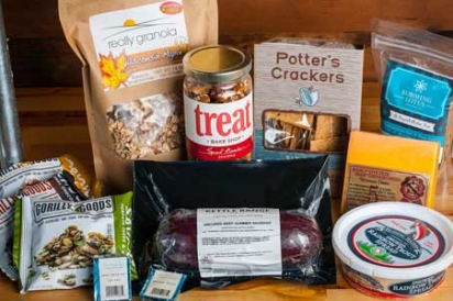
8 Great Trail Munchies From Edible Milwaukee
- Gorilly Goods, made in nearby Jackson: The chocolate snack pack is a combination of organic dark chocolate, dried bananas and coconut.
- Homemade summer sausage from Kettle Range Meat Co.
- Smoked trout from Rushing Waters atop Wisconsin-made Potters Crackers.
- Any Wisconsin cheddar. Pro storage tip: Wrap in wax paper and then loosely in plastic.
- Spiced nuts from Treat Bake Shop.
- Biscotti from Blooming Lotus Bakery on East North Ave. makes a portable breakfast.
- Really Granola, whipped up in the Wisconsin Innovation Kitchen.
- Little bites of chocolate-y delight from Indulgence Chocolatiers.


